
Memories of Humankind Seminars
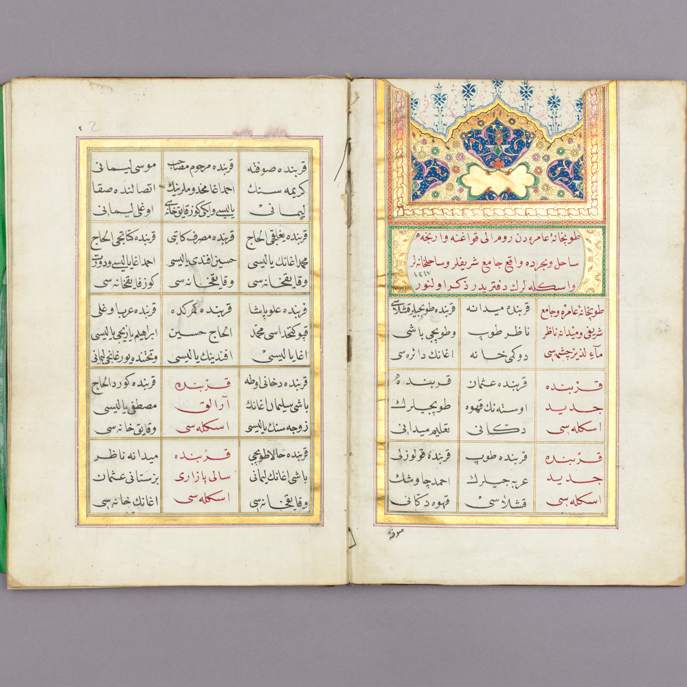
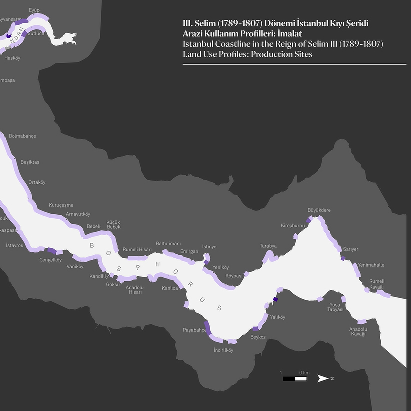
Mapping Bostancıbaşı Registers
16 January 2020 / 18:30

The dizzying pace of development in digital representation, assessment and communication technologies, from the 1990s on, can be said to eventually overshadow the age of mechanical reproduction, a Renaissance hallmark. These novel technologies grant new perspectives, new research questions, and programs to humanities and social sciences, and opens unprecedented horizons for reassessment and reinterpretation of archives and social documents that had originally been created with different purposes. These technologies provide us with new ways to reassess single microhistorical studies as well as grand narratives, and reread archives. Digitalizing Ottoman archives and rendering them accessible are possibly one of the outstanding examples to this progress.
Designed to reassess Bostancıbaşı registers through new techniques, this exploratory work consists of three parts: The first starts with a brief introduction into text mining and continues to address the register’s structure as well as spatialization and visualization opportunities. The second looks into the ways of coding the notions and terms used in the Bostancıbaşı registers of 1801 and 1803, categorizing the records on the basis of different codes, and addresses geographic coding of the records. The third part into this study’s findings, possible method-related enhancements, transferability to other examples, and potential contribution to urban historical writing.
Murat Güvenç holds undergraduate and graduate degrees from the City and Regional Planning Department, at the Faculty of Architecture, of Middle East Technical University (METU). After working as a faculty member at METU, Istanbul Bilgi University, and Istanbul Şehir University; in 2014 he was assigned as the director of Istanbul Studies Center, Kadir Has University. His published works focus on data visualization, urban geography/sociology, and institutional history. As part of the Istanbul 2010 European Capital of Culture Agency grant program, he curated the social and economic geography theme of Istanbul 1920–2010 exhibition.
Ayşe Nur Akdal majored in Urban and Regional Planning at Mimar Sinan Fine Arts University in 2012. Her graduate thesis from Boğaziçi University’s Atatürk Institute, “Market Gardens and Gardeners of Ottoman Istanbul” was published in 2016 by Libra Books.In 2018-2019, she worked as a project assistant in “Socio-Spatial Structure of Coastline of Golden Horn and Bosporus in Pre-Industrial Era: Numerical Analysis on Bostancbaşı Registers” Scientific Research Project led by Prof. Murat Güvenç. She is currently a PhD candidate at the Atatürk Institute.
Murat Tülek is a doctorate student at the Urban and Regional Planning program, Mimar Sinan Fine Arts University, and researcher for the Istanbul Studies Center of Kadir Has University. He has a BA degree from the Urban and Regional Planning, Mimar Sinan Fine Arts University in 2010. His master thesis was titled “A look into the spatial change at the Eminönü coast: Balıkpazarı and Yemiş iskelesi at the outset of the 20th century.” Since 2010, he contributed in several researches on historical and economic geography. With urban history, cartography, economic geography as his fields of interest, he studies development and visualization of historical databases, geographic information systems, and interactive mapping. He has been conducting, since 2013, an interactive mapping project: “Istanbul’s Mega Projects.” He has also been carrying out the “Changes in Daily Life after the First Bosporus Bridge” project with the support of the 2016 SALT Research Dr. Mehmet Bozdoğan scholarship.
Free of admissions; drop in. The talk will be in Turkish.
